Page 55 - Respond 2014 | RTCC Publications
P. 55
rtcc respond
The Virginia Institute of
Marine Science has a three-
part mission to conduct
interdisciplinary research in
coastal ocean and estuarine
science, educate students
and citizens, and provide
advisory service to policy
makers, industry, and the
public and is currently
among the largest marine
research and education
centers in the United States.
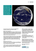
©: NASA Goddard Space Flight Centre.
It is also clear that we must begin making progress immediately because LIDAR is not yet available for all localities. Planning
implementation of adaptive measures is likely to take decades. also requires that actions occur within the regulatory
and legal framework of local government where the
Adaptation Options and Strategies enabling authority may be largely unexplored or not well
VIMS research has identifed three adaptation options for Virginia that also have broad understood. The nexus of coastal resource management
applicability worldwide: management, accommodation, and protection. Management is integration of the latest science with legal and policy
encompasses zoning policies that prevent unwise development in high-risk areas (and analysis (www.vims.edu/vcpc).
could also include retreat from the coast), while accommodation is aimed at raising
buildings and roads and enhancing storm-water systems. Future Research Needs
There is much to be learned from regional case studies.
Protection measures include engineered hard structures such as levees, seawalls, and However, strategies also require serious planning,
food gates as well as soft approaches such as marsh creation and living shorelines. commitment of signifcant resources, and careful analysis
Flexible plans that match adaptation options to the specifc circumstances of each of evolving conditions.
coastal locality are most desirable. In fact, global adaptation strategies that are
multilayered and applied in steps can together result in lower risk than any single Research needs include: 1) more accurate sea-level
measure. predications to replace reliance on past conditions to
predict the future; 2) better assessment of local variability
Budgetary, Legal and Technical Issues in sea-level rise, due in part to subsidence of land; and,
Prioritization for various actions must be based in large part on risk, followed by cost- 3) generating suitably accurate maps of coastal elevation
beneft studies of various strategies. Risks are predicted to become worse, and they that have been updated using LIDAR.
are not necessarily the same from one area to another.
Virginia Institute of Marine Science
In addition to proximity to water, assessing risk requires accurate elevation maps that www.vims.edu
must be constructed from comprehensive and highly accurate elevation data using
LIDAR, a high-resolution mapping technique that uses laser light to gauge ground
elevation.
53 www.rtcc.org